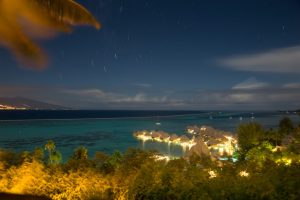
I returned to Rome this Spring for a week+ of casual hanging out and visiting new and old sights. Things have changed a lot since my last visit; nowadays one can buy a sight visit pass and make reservations on line for a whole host of new and improved Ancient Roman excavations and tours. I also saw my Roman friends and visited the Tuscan hill town of Orvieto. My trusty Canon 6D came along for the ride and never let me down.
Orvieto, Umbria
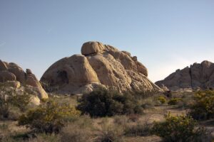
Orvieto is a classic Italian medieval hill town but it is a mere 90 minutes from Rome. It has Etruscan roots, was a Roman settlement and then a center of medieval Italian education. It was part of the Papal Territories until Italian Unification. It sits on a nearly impregnable throne of volcanic tufa 300 meters above the valley floor a few minutes’ drive off the Autostrada del Sole. Orvieto’s main attraction is the Duomo, a 13th century masterpiece of Sienese school architecture. It was built in that typical style; with alternating white and dark gray/black marble layers, similar to the duomo in Siena and contains a chapel decorated with breath-taking frescoes by Fra Angelico (the ceiling) and Luca Signorelli (the walls and lunettes). It has a beautiful façade as well and truly is a masterpiece of medieval architecture and construction.
The Façade
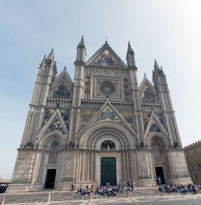
Construction started in 1290 and lasted 40 years. The façade was started in 1310 and continued for nearly 300 years, finally completed in its current form in 1609.
The Madonna of San Brizio Chapel
As masterful and beautiful the facade is, though, the real treasure is inside in the San Brizio Chapel. The chapel is covered with incredibly beautiful frescoes. The ceiling was created by Fra Angelico in 1447, the walls 50 years later by Luca Signorelli. Signorelli then painted the lunette frescoes from 1500 to 1503.
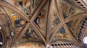
The ceiling has two themes – “Christ in Judgement” and “Angels and Prophets.” Signorelli’s walls’ themes are scenes are of the Choir of the Apostles, of the Doctors, of the Martyrs, Virgins and Patriarchs. But the lunette frescoes are the true masterworks here; considered to be among Singorelli’s best work, the lunettes display a riot of color and of human figures in all sorts of poses, contorted and otherwise.
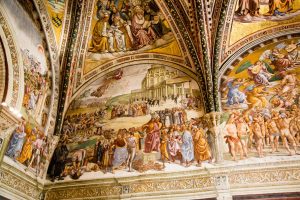
Every square inch of wall, ceiling and lunette surface is covered with these gorgeous works, truly stunning, and the amazing thing is you can get right up to them.
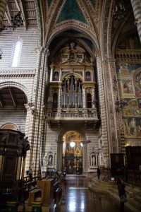
The Organ
Above the entrance of the Chapel of the Corporal and directly opposite the entrance of the San Brizio chapel stands the organ. It contains 5,585 pipes and was originally designed by Ippolito Scalza and Bernardino Benvenuti in the fifteenth century.
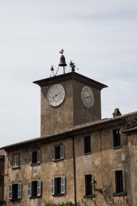
The Maurizio Tower and Clock
In the Piazza Duomo, the square next to the duomo, is a building with this fantastic clock, complete with a 1.7 m tall bronze automaton “Maurizio” that rings the bell every hour. Built in 1347, this was the time clock for the workers of the duomo. It was a true innovation; medieval timekeeping and even sense of time itself was very fluid; having a clock mandate start and stop times was revolutionary and very practical; the workers were paid by the hour, so the necessity of a clock to track each worker’s time is obvious.
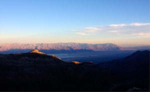
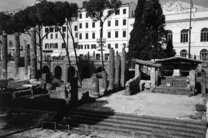
Rome, Lazio
Of course, my days in Rome were spent walking around my second home, the city I most feel at home in when I am not here. I visited my favorite spots, sat at my favorite cafes and saw my favorite Roman people. I am always struck by how strong my ties are to the Eternal City and to my friends there. Even when I feel blasé about the trip at my departure, inevitably I feel happy and excited when I land.
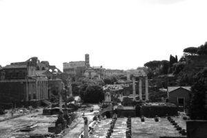
I almost always come to Rome these days with a specific photographic agenda. A few trips ago I was interested in working at night or early morning. One trip I was focused on the apse mosaics in the early Christian churches. This time I decided to look for the unusual, or at least the lesser seen.
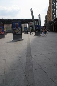
I visited the stadium superstructure ruins at the north end of Piazza Navona (Piazza Navona is built on the foundations of Domitian’s Stadium); for years all I could do was gaze longingly from the sidewalk down to the exposed ruins in front of the bank building that was built around them, but now they are open for close examination. At the Colosseum, I was excited to see that the third floor (as we Americans would say, the second level above ground level) is now open. That has always been a goal for me because until recently that level was off limits. There is also an excavated palace near Trajan’s Forum that is supposed to be very good as well. But I was unable to get into any of these because I had failed to make reservations weeks in advance. :-/ So, next time, I swear.

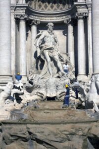
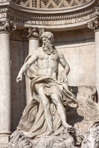 The central niche contains a statue of Oceanus.
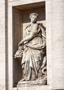 The left niche has a statue of Abundance pouring water from her urn
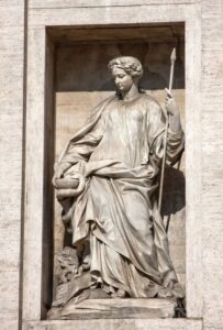 and the right niche a statue of Salubrity with a snake drinking from her cup.
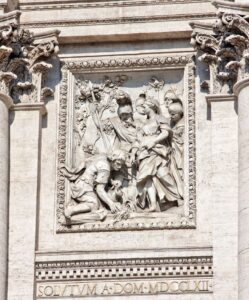 The bas relief panel above the right side niche shows the young girl (the virgin of the spring) showing the Roman soldiers the spring.
 Setting Up and Weather
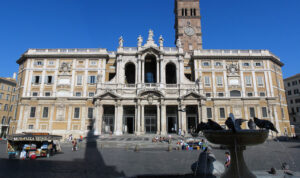
 Façade
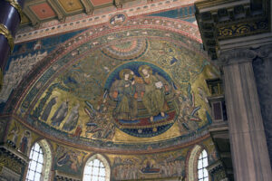
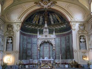 Apse
Apse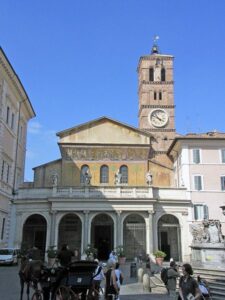 Façade
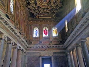
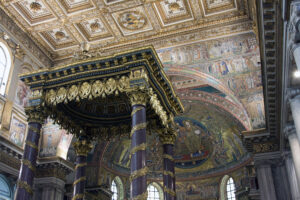
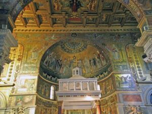 Apse and Arch Mosaics
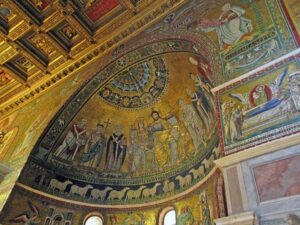 The triumphal arch’s frescoes are 19th century, the episcopal throne in the apse is ancient.